

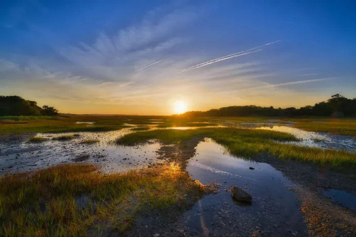


Wetlands, streams and other aquatic resources can affect where energy infrastructure can be built, how a site is laid out and which permits may be required. For developers of solar, battery energy storage, pipeline, green hydrogen and data center projects, identifying these features early can reduce the risk of redesign, permitting delays and late changes to construction plans.
A wetland delineation is a field-based assessment that identifies and maps wetlands and other aquatic resources within a defined review area. In the US, delineations are typically completed using the 1987 Corps of Engineers Wetlands Delineation Manual and the applicable USACE regional supplements. The assessment considers wetland hydrology, hydric soils and hydrophytic vegetation, and may also document streams, ditches, ponds or other aquatic features that could affect design or permitting.
The delineation does not, by itself, decide federal jurisdiction. That determination is made by the relevant regulatory authority. However, the delineation provides the technical baseline developers need to understand constraints, assess potential impacts and plan the right permitting approach. Developers planning complex energy sites may also benefit from early wetland delineation and permitting support to connect field findings with layout, impact avoidance and agency coordination.
What is a wetland delineation?
A wetland delineation identifies and maps the boundaries of wetlands, streams and other aquatic resources on a site. Field teams document whether wetland indicators are present and record the information needed to support planning, engineering and permitting decisions.
Under the federal delineation methodology, wetland identification typically considers three indicators:
- Wetland hydrology: evidence of periodic or sustained water.
- Hydric soils: soils formed under saturated conditions.
- Hydrophytic vegetation: plant communities adapted to wet conditions.
Where the applicable indicators are present, the area may meet wetland criteria under the relevant delineation methodology. Developers can then evaluate how those features intersect with proposed roads, panels, foundations, trenches, laydown areas, access routes and other construction activities.
For linear infrastructure and large energy sites, delineation should cover the full area where ground disturbance may occur, not only the main asset footprint. Access roads, collection lines, substations, temporary laydown areas, bore pits, trenching corridors and stormwater controls can all create aquatic resource impacts if they are not considered early.
Wetland delineation vs jurisdictional determination
A delineation identifies and maps aquatic resources. A jurisdictional determination addresses whether those resources are regulated under the Clean Water Act, Section 10 of the Rivers and Harbors Act or other applicable requirements. In practice, developers may use delineation data to support a request for a delineation concurrence, preliminary jurisdictional determination or approved jurisdictional determination, depending on the project need and agency process. Only the relevant regulatory authority can confirm jurisdiction.
A developer can use delineation data for site planning, engineering and permitting strategy, but should not treat the delineation alone as a final regulatory decision.
A preliminary jurisdictional determination is typically advisory and may treat aquatic resources in the review area as jurisdictional for permitting purposes. An approved jurisdictional determination provides a formal agency position on the presence or absence of jurisdictional aquatic resources and their limits. The right approach depends on project timing, risk tolerance, permitting strategy and agency workload.
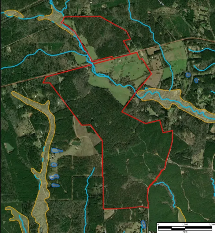
Wetland delineation for energy developments
Wetland and stream constraints can affect site layout, permitting exposure, mitigation needs, construction sequencing and project schedule. When they are identified late, project teams may need to revisit layouts, adjust impact assumptions or reopen agency discussions after budgets and delivery plans have already been set.
Early delineation helps developers answer practical planning questions:
- Where are wetlands, streams or other aquatic resources located on the site?
- Which parts of the proposed layout may create impacts?
- Can impacts be avoided or reduced through design changes?
- What permitting route may be needed?
- What information is required before agency coordination or permit applications?
For renewable energy and pipeline projects, these questions can have direct commercial implications. A small shift in panel layout, access road alignment or trench location may avoid impacts that would otherwise trigger additional permitting, mitigation or construction restrictions. Conversely, incomplete field information can create false confidence during early design.
What does a wetland delineation include?
The scope should be matched to the project, site and permitting needs. A typical wetland delineation may include:
- Desktop review of available mapping, aerial imagery, soils, hydrology and site information
- Field investigation to document wetland indicators, streams and other aquatic resources
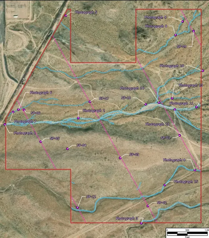
- GPS mapping of delineated boundaries and relevant site features
- Data sheets, photographs and field notes
- Maps showing aquatic resources in relation to the proposed project layout
- A technical report suitable for planning, design and potential agency review
- Support for agency coordination, where required
A stronger scope also defines the review area, survey assumptions, access limitations, field conditions and the level of agency-ready documentation required. This helps avoid a common problem: commissioning a basic field survey, then later discovering that the project needs additional mapping, impact calculations or regulatory documentation before a permit package can move forward.
When should a developer commission a wetland delineation?
Developers should consider wetland delineation before finalizing key site layout decisions. The right timing depends on site conditions, access, seasonality, permitting requirements and the maturity of the project design.
Seasonality can be important. Some sites are easier to assess during periods when hydrology, vegetation and soil indicators are visible and representative. In arid, disturbed, agricultural or heavily managed landscapes, field teams may need additional context such as recent rainfall, drainage modifications, aerial imagery or previous land use records to support defensible conclusions.
| Project stage | How delineation helps |
|---|---|
| Site screening | Identifies likely aquatic resource constraints before land control, layout or routing decisions advance too far. |
| Concept design | Helps project teams compare layout options and reduce avoidable wetland or stream impacts. |
| Pre-permitting | Provides technical information for impact assessment, agency coordination and permit strategy. |
| Detailed design | Supports construction planning, access routes, stormwater planning and documentation for permit applications. |
How delineation informs permitting strategy
Wetland delineation data helps project teams understand whether proposed activities may affect wetlands, streams or other waters and whether further coordination or permitting may be required. Under Clean Water Act Section 404, discharge of dredged or fill material into waters of the United States, including wetlands, may require a permit unless an exemption applies. Section 10 of the Rivers and Harbors Act may also apply to work in navigable waters.
For developers, the practical value is not only compliance. The delineation can help project teams assess whether impacts can be avoided, whether a general permit is appropriate, whether an individual permit is needed, and what mitigation or design changes should be considered. This is where experienced environmental consulting services can help translate delineation data into practical permitting decisions.
Where impacts cannot be avoided, the permitting strategy may need to address the sequence of avoidance, minimization and compensatory mitigation. This sequence matters because regulators generally expect applicants to first avoid aquatic resource impacts where practicable, then minimize remaining impacts before proposing compensatory mitigation for unavoidable losses.
State-specific wetland delineation requirements
Federal jurisdiction is only one part of wetland permitting strategy. Some states regulate wetlands, streams or other aquatic resources independently of federal Clean Water Act jurisdiction, while others impose additional permitting, mitigation, buffer or documentation requirements. As a result, an aquatic resource that is not federally jurisdictional may still affect project design and permitting.
State-specific considerations can be particularly important in Michigan, where wetland permitting is administered by the Michigan Department of Environment, Great Lakes, and Energy under Part 303, and in Virginia, where disturbance of wetlands and streams may require a Virginia Water Protection permit.
In North Carolina, riparian buffer rules apply to protected waters in specified river basins and watersheds and may create additional siting, authorization or mitigation considerations.
These state-specific requirements can influence the survey approach, impact analysis, agency coordination, mitigation needs and project schedule. Developers should therefore evaluate federal, state and local requirements together rather than waiting for a federal jurisdictional determination before assessing the broader permitting path.
Developers should also consider whether wetland and stream findings affect related state-specific workstreams, including threatened and endangered species review, cultural resources, stormwater design, floodplain assessment, land acquisition, constructability planning and stakeholder commitments.
When you apply for a permit, you must first show that steps have been taken to avoid impacts to wetlands, streams and other aquatic resources; that potential impacts have been minimized; and that compensation will be provided for all remaining unavoidable impacts.
Planning for changing wetland regulation
Federal wetland regulation has changed following Sackett v. EPA, including how adjacent wetlands are interpreted under the Clean Water Act. The decision narrowed federal jurisdiction in some circumstances, but it has not removed the need for careful project-specific assessment.
For project developers, a key practical issue is uncertainty. A wetland or waterbody that appears unlikely to be federally jurisdictional during early desktop review may still require field confirmation, agency coordination or a formal jurisdictional determination. Regulatory assumptions made during early development may also need to be revisited as project design advances or the applicable federal framework changes.
Changes in federal jurisdiction do not necessarily result in corresponding changes to state or local requirements. In states with independent wetland or water-resource programs, such as Michigan and Virginia, activities may remain regulated under state law even where federal jurisdiction is uncertain or absent. In North Carolina, basin- and watershed-specific riparian buffer rules may create additional considerations around certain streams and other waters.
What affects wetland delineation cost?
Wetland delineation cost varies by site and scope. Developers should be cautious about relying on generic price ranges without understanding the project context. Common cost drivers include:
| Cost driver | Why it matters |
|---|---|
| Site size and access | Larger sites, restricted access, rough terrain or multiple parcels usually require more field time, logistics planning and mapping effort. |
| Hydrology and seasonality | Recent rainfall, drought, snowmelt, irrigation, drainage modifications or seasonal water levels can affect how much supporting evidence is needed. |
| Vegetation and soils | Disturbed soils, agricultural use, mown vegetation, invasive species or mixed plant communities may require more detailed documentation. |
| Stream and drainage complexity | Ephemeral, intermittent or modified drainage features may require additional ordinary high water mark assessment or agency discussion. |
| Project layout maturity | Changing layouts can require additional mapping, impact review, revised figures or follow-up analysis. |
| Agency coordination | Delineation concurrence, preliminary jurisdictional determination, approved jurisdictional determination or permit support can add scope and schedule. |
| Reporting requirements | Maps, data sheets, photographs, impact tables, shapefiles and permit-ready documentation affect effort. |
| Schedule requirements | Accelerated timelines may require larger field teams, phased reporting or additional coordination to meet development milestones. |
Conclusion
Wetland delineation is most useful when it is completed before key site layout and permitting decisions are made.
Early field data helps developers understand where aquatic resources are present, how proposed infrastructure may interact with them and what permitting, mitigation or agency coordination may be needed.
For energy projects with tight development timelines, this clarity can reduce avoidable uncertainty and give project teams a stronger basis for siting, design, permitting strategy and stakeholder discussions.
Wood’s experience with wetland delineation for energy projects
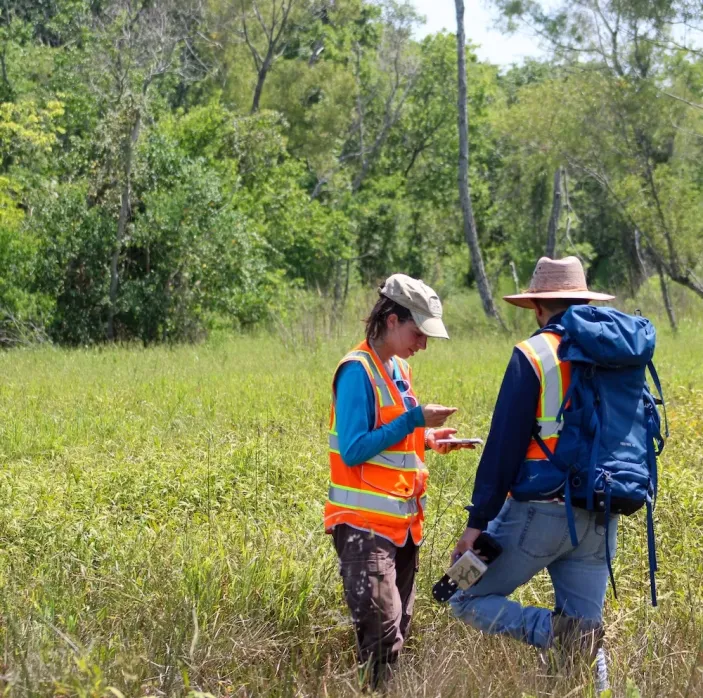
Wood’s environmental services team has completed more than 100 wetland delineations for energy projects, including solar, oil and gas, battery energy storage, green hydrogen and data center developments. This work spans a range of geographic, regulatory and site settings across the United States.
Recent representative project experience includes work in Arizona, Arkansas, Colorado, Georgia, Indiana, Louisiana, Michigan, North Carolina, South Carolina, Texas and Virginia. Wood also has agency coordination experience in multiple jurisdictions, including Arizona, Michigan, North Carolina, South Carolina and Texas.
For developers, the value of goes beyond field execution. A strong delineation consultant connects field findings to layout decisions, impact calculations, permitting strategy, agency coordination and project schedule. This is particularly important when environmental due diligence runs alongside land acquisition, interconnection, engineering and commercial milestones.
Contact our environmental services team to discuss your next development project.
FAQs
What is the purpose of a wetland delineation?
The purpose is to identify and map wetlands, streams and other aquatic resources so developers can understand site constraints, assess potential impacts and plan the appropriate permitting path.
Does a wetland delineation confirm federal jurisdiction?
No. A delineation provides the technical baseline. Federal jurisdiction must be confirmed by the relevant regulatory authority through the appropriate process.
When should wetland delineation happen?
A wetland delineation is most useful before layout freeze, major engineering decisions or permit application preparation. Early delineation gives developers more options to avoid or reduce impacts.
What drives wetland delineation cost?
Cost is usually shaped by site size, access, field conditions, hydrology, vegetation, soils, reporting requirements and the level of agency coordination needed. Read more about wetland delineation cost factors.
What should developers prepare before fieldwork?
Useful inputs include site boundaries, proposed layouts or route options, access information, known constraints, previous environmental reports, schedule assumptions and any agency correspondence already received.
Is a desktop screening sufficient?
Desktop screening is useful for early risk identification, but it should not be treated as a substitute for field delineation where wetlands, streams or regulated aquatic resources could affect project design or permitting.
Public mapping can be incomplete, outdated or too coarse for site-level decisions.
Can wetland delineation reduce project cost?
It can help reduce avoidable cost by identifying constraints early enough for the project team to consider alternative layouts, access routes or construction methods.
What makes a wetland delineation defensible?
A defensible delineation uses the applicable methodology, clearly defines the review area, documents field indicators, explains assumptions and limitations, includes maps and data sheets and is prepared in a format that can support planning, agency coordination or permitting.
Author
-

Erin Cozart
Project Development Team Lead
 Connect
About this article
Standards and regulatory context
This article reflects current US wetland delineation practice and is aligned with the 1987 Corps of Engineers Wetlands Delineation Manual and the applicable USACE regional supplements. It also reflects the role of Clean Water Act Section 404 permitting, USACE jurisdictional determinations and current regulatory uncertainty following Sackett v. EPA.
Professional review
This content has been developed for review by environmental professionals with experience supporting wetland delineation, aquatic resource assessment, environmental due diligence and permitting strategy for energy, infrastructure and development projects.
Practical experience
The guidance presented is informed by Wood’s practical experience delivering wetland delineation and environmental permitting support for renewable energy, pipeline, battery energy storage, green hydrogen and data center projects across a range of US regulatory and site settings.
Last reviewed: August 2026.